Transform satellite imagery from Earth Engine into tabular data in BigQuery
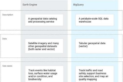
Geospatial data has many uses outside of traditional mapping, such as site selection and land intelligence. Accordingly, many businesses are finding ways to incorporate geospatial data into their data warehouses and analytics. Google Earth Engine and BigQuery are both tools on Google Cloud Platform that allow you to interpret, analyze, and visualize geospatial data.


